Understand
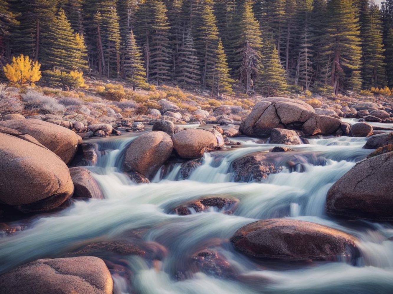
The White Mountains, a stunning range within the Great Basin of the western United States, offer a majestic beauty that cannot be missed. Stretching approximately 60 miles long, this north-south fault block range begins as an elevated plateau at Westgard Pass. As you travel northward, the plateau narrows and rises to a breathtaking elevation of over 13,000 feet at Montgomery and Boundary Peaks. The range eventually tapers and comes to an end at Montgomery Pass. The crown jewel of the White Mountains, White Mountain Peak, stands tall at an impressive height of 14,252 feet. This magnificent mountain is essentially an extinct volcano set atop a triangular plateau, located 15 miles south of the range's highest point. While it may not be the highest mountain range in California, it holds the title of being the highest range entirely within the Great Basin. The nearby Sierra Nevada range boasts slightly higher peaks, making White Mountain Peak California's third-highest summit and one of the top twenty highest peaks in the entire United States, excluding Alaska. The Owens Valley serves as a natural boundary, separating the White Mountains from the Sierra Nevada. Explore the pristine beauty of the White Mountains and witness nature at its most awe-inspiring.
Get in
The primary way to reach the range is by road. If you are coming from the northern outskirts of Los Angeles, you can take State Route 14 and U.S. Route 395. Traveling from the San Francisco area, you can opt for State Route 120 over Tioga Pass during the summer or other passes via California routes 108, 4, or 88 further north. U.S. 50 alongside Lake Tahoe is another option, which remains open all year. In most cases, you will need to take U.S. 395 south for at least an hour. Another option is to take California Highway 168, which departs from U.S. 395 at Big Pine. This route crosses Westgard Pass at the south end of the range. From the pass, a paved access road leads to Schulman Grove at around 10,000'. Beyond the higher Patriarch Grove, a gravel road ascends into the alpine zone. Most cars can carefully drive it to the Barcroft Labs research complex at 12,500', although the gate is usually two miles below. U.S. 395 follows Owens Valley from Big Pine to Bishop. After that, U.S. Highway 6 starts north of Bishop. It follows the Chalfant and Queen Valleys immediately west of the range and crosses Montgomery Pass at the north end. Just north of the Nevada State Line, a gravel road branches off and can be navigated by regular cars up to Queen Mine, which is located at around 8,000' (2,400m). A more rough extension, requiring 4wd, leads to the crest at approximately 10,000' (3,000m) elevation, serving as a recommended trailhead for climbing Nevada's highest point. On the eastern side of the range in Nevada, there is a paved road called Nevada Route 264. It crosses Fish Lake Valley. Keep in mind that gasoline and services are only available in the town of Dyer. Numerous gravel roads branch off into the canyons of the east side, offering access to higher elevations. These roads can be cautiously driven by 2wd vehicles with sufficient clearance, and 4wd vehicles can reach even higher points. Before embarking on these journeys, it's advisable to consult topographic maps and seek local opinions. Traveling in convoys is also a wise decision, and it's always a good idea to scout iffy stretches on foot.
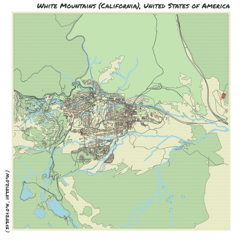
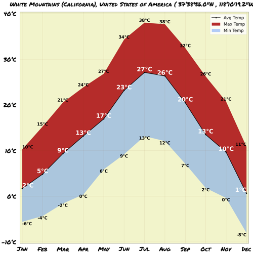
Map & Climate
Popular Foods
 **1. Hamburger**The hamburger, often simply called a burger, is a sandwich consisting of a cooked patty of ground beef, usually served in a bun with toppings and condiments such as lettuce, tomato, onion, cheese, and pickles. It is a quintessential American fast food item that can be found at restaurants, fast food joints, and even street vendors throughout the country. While traditional hamburgers typically include beef, there are also vegetarian options available made from plant-based ingredients.
 **2. Pizza**Pizza is a popular Italian-American dish consisting of a yeasted flatbread base, typically topped with tomato sauce, cheese, and various other ingredients such as meats, vegetables, and herbs. In the United States, pizza is often sold as both a take-out and sit-down dining option, with numerous regional variations in styles and toppings. Pepperoni is a particularly popular topping in the U.S., but vegetarian and vegan pizzas are also widely available.
 **3. Fried Chicken**Fried chicken is a southern-style dish comprised of marinated chicken pieces that are coated in a seasoned flour mixture and deep-fried until golden brown and crispy. Originating from the American South, fried chicken has become a staple in the country's culinary landscape, with various regional variations in preparation styles and seasonings. It can be enjoyed as a standalone meal or as part of a larger feast, and although traditionally prepared with chicken, vegetarian alternatives do exist.


Comments
NO COMMENTS