Understand
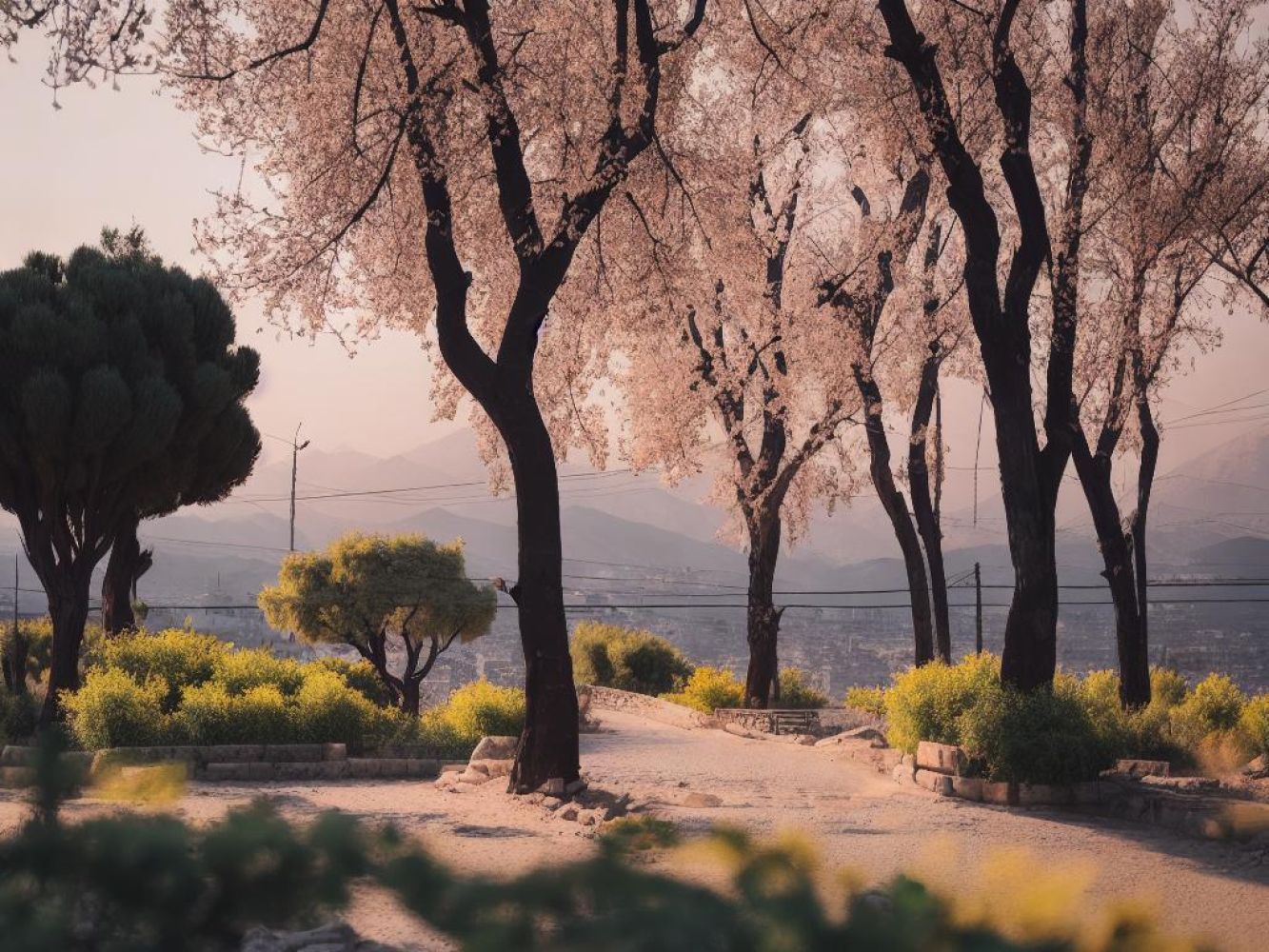
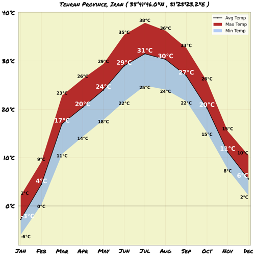
The province of Tehran, located in Iran, is home to over 12 million people, making it the most densely populated region in the country. The majority, about 84.15%, live in urban areas, while the remaining 15.85% reside in rural parts of the province. Tehran province is characterized by its diverse geography. The highest point in the province is Mount Damavand, towering at an elevation of 5,678 meters. On the other hand, the lowest point can be found in the plains of Varamin, sitting at 790 meters above sea level. Within the province, there are several notable lakes, including the Karaj River and Jajrud River. These bodies of water contribute to the province's natural beauty. The landscape of Tehran province is adorned with majestic mountain ranges. The Alborz mountain range stretches across the north, while Savad Kooh and Firooz Kooh can be found in the northeast. In the south, you'll encounter Lavasanat, Qarah Daq, Shemiranat, Hassan Abad, and Namak Mountains. As you venture to the southeast, you'll encounter Bibi Shahr Banoo and Alqadr. Finally, to the east lies the heights of Qasr-e-Firoozeh. When it comes to climate, Tehran province experiences a range of temperatures depending on its geography. The southern areas have a moderately warm climate, while the mountainous areas can be quite cold. In the higher regions, winters are long and snowy. The hottest months are from mid-July to mid-September, with temperatures reaching around 28-30 degrees Celsius. In contrast, the coldest months experience temperatures as low as -10 degrees Celsius in December-January. Tehran city itself has cold winters and hot summers, offering a diverse climate experience. Overall, Tehran province is known for its stunning landscapes, diverse geography, and varying climates, making it a fascinating destination to explore. Don't forget to pack your camera and dress accordingly for the weather!
Map & Climate
Popular Foods
 Dish 1: Persian Kebab (Kebab-e Sabzi)The Persian Kebab is a beloved Iranian dish consisting of skewered, grilled meat (usually beef, lamb, or chicken) seasoned with onions, tomato paste, saffron, turmeric, and other aromatic herbs and spices. It's typically served alongside rice, grilled tomatoes, and savory herbs like parsley and chives.
  Dish 2: Tahchin (Tahchin-e Morgh)Tahchin is a comforting, traditional Persian dish made with basmati rice, cooked in a savory tomato sauce, and layered with tender pieces of chicken, then baked until fragrant and delicious. The dish is often garnished with fried onions, barberries, and a dollop of creamy mast-o-khiar (yogurt mixed with cucumber and walnuts).
  Dish 3: Ghormeh Sabzi (Herb Stew)Ghormeh Sabzi is a filling, vegetarian stew characterized by its vibrant assortment of aromatic herbs (such as parsley, coriander, dill, and chives), tender white beans, and melt-in-your-mouth potatoes, all simmered in a rich, flavorful broth. This hearty dish is often enjoyed with a side of basmati rice or flatbread.


Comments
NO COMMENTS