Understand
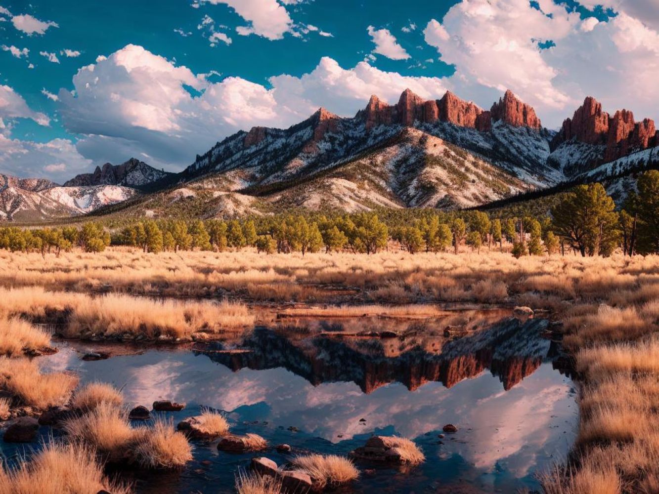
The Sangre de Cristos, located in the southernmost part of the Rocky Mountains, are a majestic range that rise nearly 8000 feet above the Great Plains to the east and overlook the beautiful Espaola Valley to the west. This powerful topographical barrier played a significant role in shaping the settlement of the Southwest by "Anglos" who arrived from the eastern United States. Forced southward by the mountains, these pioneers encountered both American Indian communities along the Rio Grande and Spanish colonial settlements in Santa Fe, Albuquerque, and other places, leading to cultural mixing, and occasionally, conflict. The unique blend of the three cultures continues to leave a lasting impact on the region. Wheeler Peak, the highest summit in the Sangres in New Mexico, stands at an elevation of 13,161 feet, although summits in the Colorado extension of the range exceed 14,000 feet. These mountains offer remarkable recreational opportunities due to their unusually high timberline, reaching around 12,000 feet in some areas, and the absence of permanent snowfields. From breathtaking hiking and backpacking routes in the summer to thrilling downhill ski resorts in the winter, the Sangres provide diverse experiences for outdoor enthusiasts. Remember to consider the changing seasons when planning your trip. As you explore the towns nestled along the eastern slopes of the Sangre de Cristos, you'll find them deeply connected to the neighboring Great Plains, while those on the west side are more influenced by the Hispanic and Native American settlements along the Rio Grande. While the west-side towns have well-developed tourism resources, the east-side towns tend to be relatively poorer. The challenging mountain terrain makes agriculture difficult, and mining activities have limited potential. Nevertheless, expect comfortable, although not luxurious, accommodations in most towns outside of major tourist centers or along major roads. Rest assured, you'll have access to essential amenities like potable water and utilities, although cellular phone coverage may be spotty due to the rugged terrain.
Get in
If you're looking for access information to explore the western side of the range, you can find it in the entries for Taos and Santa Fe. For those planning to visit the towns and locations on the eastern slopes, road access is available via highways from Interstate 25 near Raton. The easiest way to reach the small towns of Eagle Nest, Red River, and Angel Fire on the northeast side is through US Highway 64. If you're heading to Sapello and nearby areas, you can reach them from Las Vegas using New Mexico State Road 518. Lastly, if you're planning to visit Pecos, Cowles, or any of the southeast-side trailheads, you can take State Road 63 between Las Vegas and Santa Fe. However, please note that the east-side roads can be challenging or even impassable during winter storms.
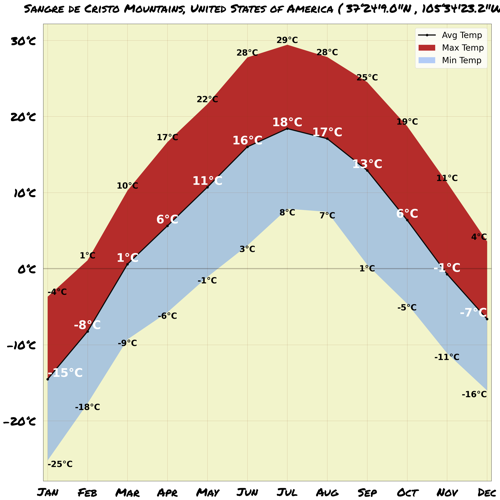
Map & Climate
Map & Climate
Popular Foods
 **1. Hamburger**The hamburger, often simply called a burger, is a sandwich consisting of a cooked patty of ground beef, usually served in a bun with toppings and condiments such as lettuce, tomato, onion, cheese, and pickles. It is a quintessential American fast food item that can be found at restaurants, fast food joints, and even street vendors throughout the country. While traditional hamburgers typically include beef, there are also vegetarian options available made from plant-based ingredients.
 **2. Pizza**Pizza is a popular Italian-American dish consisting of a yeasted flatbread base, typically topped with tomato sauce, cheese, and various other ingredients such as meats, vegetables, and herbs. In the United States, pizza is often sold as both a take-out and sit-down dining option, with numerous regional variations in styles and toppings. Pepperoni is a particularly popular topping in the U.S., but vegetarian and vegan pizzas are also widely available.
 **3. Fried Chicken**Fried chicken is a southern-style dish comprised of marinated chicken pieces that are coated in a seasoned flour mixture and deep-fried until golden brown and crispy. Originating from the American South, fried chicken has become a staple in the country's culinary landscape, with various regional variations in preparation styles and seasonings. It can be enjoyed as a standalone meal or as part of a larger feast, and although traditionally prepared with chicken, vegetarian alternatives do exist.


Comments
NO COMMENTS